Indian Peaks

Indian Peaks is an excellent location located just south of Rocky Mountain National Park. While the park lacks the large sweeping valleys, it contains much of the same high mountain beauty that you can find in the longer hikes of RMNP. The mountains loom over you once you get far enough giving you the same kind of feel you can find on your way up to Chasm lake, but almost more scenic. As you approach Blue Lake, you pass many smaller calm crystal clea

r ponds and great piles of boulders littered with strange spiders that bounce in their web. Throughout the trails are numerous wildflowers that gather around the many streams leading to the ponds. Morning light can make these locations glow, but only if you brave the numerous mosquitoes that sometimes fill the lower parts of the trail.

Indian Peaks unfortunately becomes rather inaccessible during the winter months. A gate closes with the first serious snow fall, which extends round hikes by approximately 3 miles. Coupled with the snow it makes hiking there in the winter tiring. Further complicating winter hiking is that the three times I have been there during the winter, I experienced white out blizzard conditions. Like all high mountain locations, weather can be unpredictable but such hikes can be particularly rewarding emotionally. The gate tends to open in late May and closes in September or October.

In the summer, The Blue Lake Trail or the Mitchell Lake trail are relaxing and rewarding afternoon hikes. Expect ice to vary amounts all year around. When I was there in late July standing snow was still present as well as glacial ice and floating ice in Blue Lake. With the ice and blue co
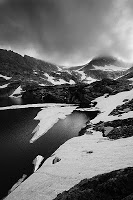
lor Blue Lake is the gem of the park. Various small water falls feed it surrounded by purple and pale yellow flowers and rather tame marmots and mountain grouse can be found near its edge.

During the summer months, park can be busy, especially on the weekends but no exclusively. Come early both for the better light and so you can even find a spot to park while avoiding the crowds. Parking is rather limited, so even when the park is full, once you are out on the trails it does not seem crowded. You are aware of other people, but it is not the point where you feel like a touron standing at the side of the road in RMNP watching elk. Most people stay near Long Lake to camp, fish, and picnic leaving the trails for people who will appreciate them. If you choose to go in the winter, you will likely need to pick up a day pass in a nearby town that is authorized to sell them. They do not sell passes at the park gate during the winter. I do not know if you need a pass in the winter, I have a universal state park pass so I never looked into it.

For more photos of the area, refer to:

my flickr

Gross Reservoir/WildFire

Gross Reservoir is an interesting location near Denver that can easily be accessed en route to Indian Peaks or the mountain highway route to Rocky Mountain National Park for access to Long's Peak. It works particularly well as a quick side trip as not much hiking is required at all. There are three areas for parking that be reached from the highway turn off for it, and more in a private property area. From the three lots good vantage points can be found along with easy access to the shoreline. Unfortunately the park closes at sunrise and sunset rather firmly. Since the area is a water supply, there are always rangers present.

The area in interesting to shoot because you have a large lake in relatively dynamic mountains. Further since the lake is artificial, strong lines have formed along the edges of it. There are several sweeping vantage points from which good panoramas can be made of a sunsets (if you are lucky enough to get a decent one) but doing them for the shores usually is an exercise in futility. Strong winds whip the lake, particularly around an aptly named Windy Point making the water hard to blend the sky equally as difficult.

Nearby are Walker Ranch and the western access to El Dorado Canyon at which a fire burned last fall. On the way back from Gross Reservoir I saw what I assumed to be a controlled burn and pulled off to the side of road. There was middle age pot bellied man walking around a fire. The fire at this point was rather small, smaller than most livings. I grabbed my camera and addressed the man, asking if this was a controlled burned, and after a rather confused exchanged it became clear that this was not and that it had been started by accident. He was trying to stomp it out and asked my to help, but it after a minute or so of doing so it seemed rather futile. The fire started at the top of a wide grass valley with sparse tree cover. Blowing down into a the valley was strong gusting wind, which whenever it gusted would jet the flames over my head. The fire was spreading, fast, and seemed to be inline to go rushing down the valley into a pine forest and then over the last set of mountains to the plains in between Denver and Boulder. It was at this point that it struck me to ask if he had called the fire department. He had not.

After another confused conversation, but this time with 911, the fire department was deployed. The dispatcher had no idea where El Dorado Canyon was and I had no idea what county I was in so it took us a minute to figure it out. It took them 15-20 minutes to get the first truck to us, during which most of the photos I have were taken. After arriving they banned from the area and preceded to set up for the next wave of firefighters. It took them 4 hours, but in the end they got it. As I was driving back to Denver, I spotted large tankers preparing for if the fire managed to hit the high plains, but it never did.

Photos of Gross Reservoir can be found here:

flickr

Photos of the Fire can be found here:

flickr

Wheeler Geologic Area

Wheeler is a photographer's wet dream. The formation is large, convex, and south facing getting marvelous light at just about any time of day. Further Wheeler is a bugger to get to. The formation is located east of Creede Colorado in southern part of the state (west of the sand dunes). Off a particularly scenic highway you rather immediately get a tease of what you are going to find as you drive up a rather well maintained but steep in some areas cattle road. This drive takes progressively higher through cattle land and scenic aspen groves occasionally giving a scenic view of the valley bellow. The aspen groves are intermittent making it easy find area that you do not find yourself including the tops of the trees unattractively in the foreground. Eventually you come to the trail head and the start of a very primitive road near an old mill. Unfortunately the remnants of the mill are nothing more than impressive pile of saw dust and bits of twisted metal.

Here you have a choice of an 8 mile hike ( I have seen some people call it a 6 mile and others a 9 mile) or a 14 mile drive. While the drive is tempting, the sign at the entrance of this road forebodes what is ahead. A tow out at this area exceeds 400$ an hour and the road is closed when snow is present. I have been over both. The road is narrow moving in out of forests with numerable small hills at the base of which mud forms. In any kind of rain or snow making this road could become rather unfeasible. In good conditions I have seem 2 wheel drive cars with moderate clearance not have too much trouble with it. The trail is another story.

The tail is to be frank is gorgeous. You hike a long a trail that descends steeply into a canyon while intermittently flows of broken igneous rock cross the trail creating strange patterns. Eventually you reach a stream which you could follow further down into a more dynamic area of the canyon but is in the wrong direction to reach the formations. From there the trail becomes tedious, slowly climbing until meeting up with the road which had to circumnavigate the canyon. From there it goes up and then back down, but not dramatically or strenuously, until you reach the campsite at the base of the formation. Luckily for those of us backpacking there is a stream located within spitting distance of the campsite. I suspect that at times it could run dry, but when I was there in September it still had low but healthy flow. Gold dust is present in this stream. When I was there, an amateur gold panner was practicing her art for fun.

From the campsite, there is a mile and a quarter trail loop around the formation. A direct approach I imagine could be possible, but it would be difficult going, more so if you are carrying a tripod. The trail does provide many good vantage points for photographing the formation. In the morning and evening it can be particularly beneficial to exit the trail and hop around the formations. The strong side light can get trapped between the rocks creating strong warm glows. In the formation itself are coniferous trees, but prior to them is another patch of aspen trees.

Since Wheeler is located in a low populated area, is rather hard to get to, and is considered a Geologic area in a National Forest the area's number of visitors is small. This makes it ideal for photographers looking for a slightly more esoteric location than the national parks. The most common visitor to the park is climbers looking to practice on a nearby technical climb location.

The presences of the coveted aspen and lack of rain makes fall the best photographic time to visit this location. However the threat of the stream running dry makes me place a cavet before recommending this time of year. Make sure that stream is flowing before backpacking in without water.

Unfortunately I have had only one rather unproductive trip out to location, refer to:

my flickr